
File:Bou Craa mine.jpg
Size of this preview: Amachashazikazi ama-459 adlulayo nama-599 amile. Other resolutions: Amachashazikazi ama-184 adlulayo nama-240 amile | Amachashazikazi ama-540 adlulayo nama-705 amile.
Ifayela ewu ngqo (540 × 705 pixels, file size: 312 KB, MIME type: image/jpeg)
| Incazelo |
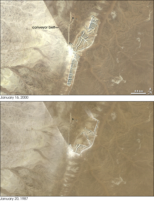
English: Bou Craa phosphate mine, phosphate mine, 100 kilometers (about 60 miles) from the coastal city of El Aaiún, Western Sahara.
NASA image created by Jesse Allen, using Landsat data provided by the United States Geological Survey. |
|||||
| Usuku | Posted October 5, 2008 | |||||
| Umthombo | http://earthobservatory.nasa.gov/IOTD/view.php?id=35524 | |||||
| Umlobi | NASA Landsat image | |||||
| Permission (Reusing this file) |
|

Umlando womqulu
Click on a date/time to view the file as it appeared at that time.
| Usuku/Isikhathi | Isithonjana | Dimensions | Umsebenzisi | Amazwana | |
|---|---|---|---|---|---|
| Njengamanje | 04:26, 4 uNdasa 2010 | | 540 × 705 (312 KB) | Tillman | {{Information |Description={{en|1=Bou Craa phosphate mine, phosphate mine, 100 kilometers (about 60 miles) from the coastal city of El Aaiún, Western Sahara. NASA image created by Jesse Allen, using Landsat data provided by the United States Geological |
Ukusetshenziswa komqulu
The following page uses this file:
Ukusetshenziswa komqulu jikelele
Amanye ama-wiki asebenzisa lefayela
- Ukusetshenziswa ku-ar.wikipedia.org
- Ukusetshenziswa ku-ca.wikipedia.org
- Ukusetshenziswa ku-ceb.wikipedia.org
- Ukusetshenziswa ku-en.wikipedia.org
- Ukusetshenziswa ku-es.wikipedia.org
- Ukusetshenziswa ku-eu.wikipedia.org
- Ukusetshenziswa ku-fr.wikipedia.org
- Ukusetshenziswa ku-ha.wikipedia.org
- Ukusetshenziswa ku-ig.wikipedia.org
- Ukusetshenziswa ku-it.wikipedia.org
- Ukusetshenziswa ku-nl.wikipedia.org
- Ukusetshenziswa ku-pl.wikipedia.org
- Ukusetshenziswa ku-pt.wikipedia.org
- Ukusetshenziswa ku-pt.wikibooks.org
- Ukusetshenziswa ku-ru.wikipedia.org
- Ukusetshenziswa ku-sh.wikipedia.org
- Ukusetshenziswa ku-simple.wikipedia.org
- Ukusetshenziswa ku-ts.wikipedia.org
- Ukusetshenziswa ku-uk.wikipedia.org
- Ukusetshenziswa ku-www.wikidata.org
- Ukusetshenziswa ku-yo.wikipedia.org
- Ukusetshenziswa ku-zh.wikipedia.org