
File:Botswana location map.svg

Size of this PNG preview of this SVG file: Amachashazikazi ama-577 adlulayo nama-600 amile. Other resolutions: Amachashazikazi ama-231 adlulayo nama-240 amile | Amachashazikazi ama-462 adlulayo nama-480 amile | Amachashazikazi ama-739 adlulayo nama-768 amile | Amachashazikazi ama-986 adlulayo nama-1,024 amile | Amachashazikazi ama-1,971 adlulayo nama-2,048 amile | Amachashazikazi ama-974 adlulayo nama-1,012 amile.
Ifayela ewu ngqo (SVG file, nominally 974 × 1,012 pixels, file size: 314 KB)
Isifinyezo
| Incazelo |
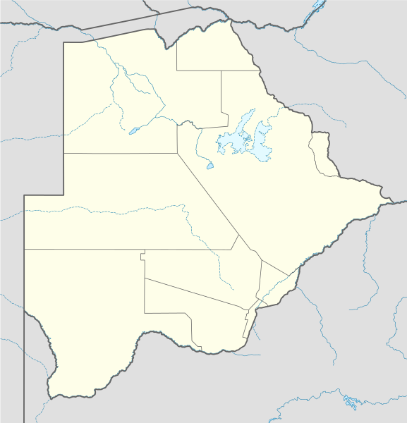
Deutsch: Positionskarte von Botsuana
Quadratische Plattkarte, N-S-Streckung 105 %. Geographische Begrenzung der Karte:
English: Location map of Botswana
Equirectangular projection, N/S stretching 105 %. Geographic limits of the map:
|
||
| Usuku | |||
| Umthombo |
own work, using
|
||
| Umlobi | NordNordWest | ||
| SVG genesis |
|

Licensing
I, the copyright holder of this work, hereby publish it under the following licenses:

|
Permission is granted to copy, distribute and/or modify this document under the terms of the GNU Free Documentation License, Version 1.2 or any later version published by the Free Software Foundation; with no Invariant Sections, no Front-Cover Texts, and no Back-Cover Texts. A copy of the license is included in the section entitled GNU Free Documentation License. |
This file is licensed under the Creative Commons Attribution-Share Alike 3.0 Unported license.
- Ukhululekile:
- ukwabelana – to copy, distribute and transmit the work
- to remix – to adapt the work
- Ngaphansi kwezimo ezilandelayo:
- attribution – You must give appropriate credit, provide a link to the license, and indicate if changes were made. You may do so in any reasonable manner, but not in any way that suggests the licensor endorses you or your use.
- yabelana ngokufana – If you remix, transform, or build upon the material, you must distribute your contributions under the same or compatible license as the original.
You may select the license of your choice.
Umlando womqulu
Click on a date/time to view the file as it appeared at that time.
| Usuku/Isikhathi | Isithonjana | Dimensions | Umsebenzisi | Amazwana | |
|---|---|---|---|---|---|
| Njengamanje | 10:07, 21 uZibandlela 2014 | | 974 × 1,012 (314 KB) | Ravenpuff | Chobe District |
| 20:37, 11 uLwezi 2009 |  | 974 × 1,012 (313 KB) | NordNordWest | ||
| 17:48, 13 uNcwaba 2008 |  | 975 × 1,012 (222 KB) | NordNordWest | {{Information |Description= {{de|Positionskarte von Botsuana}} Quadratische Plattkarte, N-S-Streckung 105 %. Geographische Begrenzung der Karte: * N: 17.3° S * S: 27.5° S * W: 19.4° O * O: 29.7° O {{en|Location map of [[:en:Botswana|B |
Ukusetshenziswa komqulu
The following 72 pages use this file:
- Bobonong
- Bokaa
- Borolong
- Chadibe
- Dukwi
- Gabane
- Ghanzi
- Hukuntsi
- Kanye, Butswana
- Kasane
- Khudumelapye
- Kopong
- Kumakwane
- Lecheng, Butswana
- Lentsweletau
- Lerala
- Letlhakane
- Letlhakeng
- Lotlhakane
- Mahalapye
- Maitengwe
- Malolwane
- Mandunyane
- Manyana, Butswana
- Marobela
- Masunga
- Mathangwane
- Maun, Butswana
- Maunatlala
- Metsimotlhabe
- Mmadinare
- Mmankgodi
- Mmathethe
- Mmopane
- Mochudi
- Mogoditshane
- Moiyabana
- Molapowabojang
- Mookane
- Mopipi
- Moshupa
- Nata, Butswana
- Nkange
- Nokaneng
- Oodi
- Otse, Butswana
- Otse, Central District
- Palapye
- Rakops
- Ramokgonami
- Ramotswa
- Ranaka
- Sebina
- Sefophe
- Sehithwa
- Seronga
- Serowe
- Shakawe
- Shashe-Mooke
- Shorobe
- Shoshong
- Tati Siding
- Thabala
- Thamaga
- Tlokweng
- Tobane
- Tonota
- Toteng
- Tsabong
- Tsetsebjwe
- Tumasera
- Template:Location map Botswana
Ukusetshenziswa komqulu jikelele
Amanye ama-wiki asebenzisa lefayela
- Ukusetshenziswa ku-af.wikipedia.org
- Maun
- Lobatse
- Francistown
- Ghanzi
- Kasane
- Mochudi
- Palapye
- Kanye
- Mahalapye
- Serowe
- Molepolole
- Tshabong
- Ramotswa
- Kalkfontein
- Selebi-Phikwe
- Gumare
- Masunga
- Tlokweng
- Jwaneng
- Bobonong
- Moshupa
- Orapa
- Thamaga
- Kang
- Sikwane
- Sowa, Botswana
- Zutswa
- Werda, Botswana
- Struizendam
- Tshane
- Vaalhoek
- Middelputs
- Bokspits
- Khuis
- Rapplespan
- Sir Seretse Khama Internasionale Lughawe
- Tuli-blok
- Makopong
- D'Kar
- Kasane Lughawe
- Francistown-lughawe
- Ukusetshenziswa ku-am.wikipedia.org
- Ukusetshenziswa ku-ar.wikipedia.org
- Ukusetshenziswa ku-arz.wikipedia.org
- Ukusetshenziswa ku-ast.wikipedia.org
View more global usage of this file.