
File:EU-Ireland.svg

Size of this PNG preview of this SVG file: Amachashazikazi ama-713 adlulayo nama-600 amile. Other resolutions: Amachashazikazi ama-285 adlulayo nama-240 amile | Amachashazikazi ama-571 adlulayo nama-480 amile | Amachashazikazi ama-913 adlulayo nama-768 amile | Amachashazikazi ama-1,218 adlulayo nama-1,024 amile | Amachashazikazi ama-2,435 adlulayo nama-2,048 amile | Amachashazikazi ama-2,045 adlulayo nama-1,720 amile.
Ifayela ewu ngqo (SVG file, nominally 2,045 × 1,720 pixels, file size: 7.33 MB)
Isifinyezo
| Incazelo |
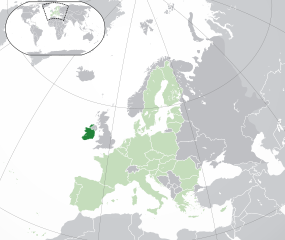
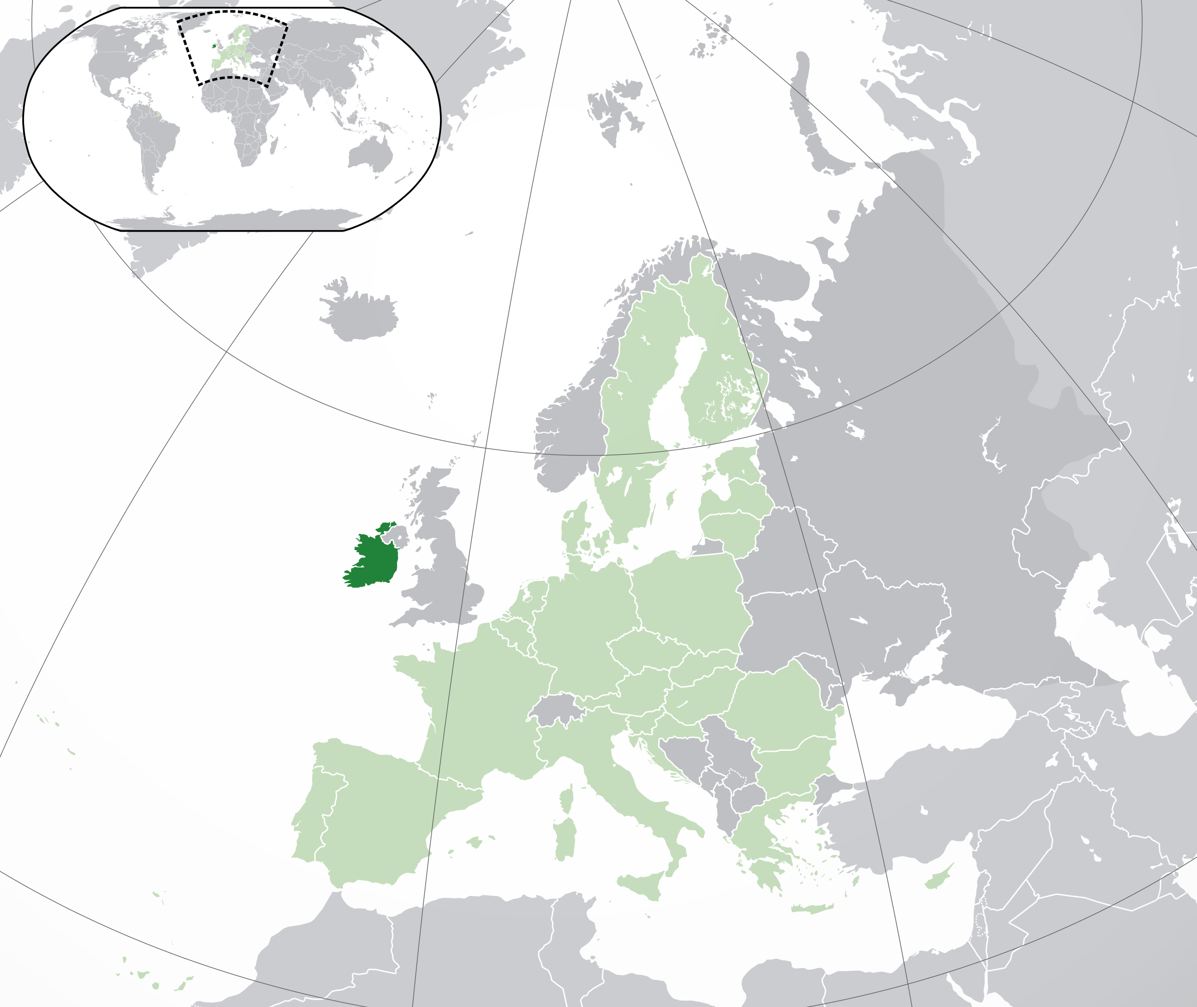
English: (Dark-Green) Republic of Ireland. (Light-Green) The rest of the European Union (EU). (Dark-gray) The rest of Europe. (Light-gray) The surrounding region.
See also: |
| SVG genesis | |
| Usuku | |
| Umthombo | |
| Umlobi | NuclearVacuum |
| Other versions |
|


_in_Europe.png)
Licensing
I, the copyright holder of this work, hereby publish it under the following licenses:
This file is licensed under the Creative Commons Attribution-Share Alike 3.0 Unported license.
- Ukhululekile:
- ukwabelana – to copy, distribute and transmit the work
- to remix – to adapt the work
- Ngaphansi kwezimo ezilandelayo:
- attribution – You must give appropriate credit, provide a link to the license, and indicate if changes were made. You may do so in any reasonable manner, but not in any way that suggests the licensor endorses you or your use.
- yabelana ngokufana – If you remix, transform, or build upon the material, you must distribute your contributions under the same or compatible license as the original.

|
Permission is granted to copy, distribute and/or modify this document under the terms of the GNU Free Documentation License, Version 1.2 or any later version published by the Free Software Foundation; with no Invariant Sections, no Front-Cover Texts, and no Back-Cover Texts. A copy of the license is included in the section entitled GNU Free Documentation License. |
You may select the license of your choice.
| Annotations | This image is annotated: View the annotations at Commons |
Umlando womqulu
Click on a date/time to view the file as it appeared at that time.
| Usuku/Isikhathi | Isithonjana | Dimensions | Umsebenzisi | Amazwana | |
|---|---|---|---|---|---|
| Njengamanje | 05:03, 1 uNhlolanja 2020 | | 2,045 × 1,720 (7.33 MB) | Rob984 | UK and Gibraltar have left the EU. New base which includes all of Portugal's islands within frame, as well as Arctic Russian islands part of Europe. Also fixed Flevoland in the Netherlands. |
| 20:31, 25 uMfumfu 2016 |  | 2,045 × 1,720 (7.32 MB) | Giorgi Balakhadze | Rv of sockpuppet and per COM:OVERWRITE | |
| 15:59, 18 uNdasa 2015 |  | 2,045 × 1,720 (7.38 MB) | Mapclean | Reverted to Leftcry's version, please go to your talk page | |
| 14:07, 21 uNhlolanja 2015 |  | 2,045 × 1,720 (2.62 MB) | VS6507 | Spain. Greece. Slovakia. Cyprus. Romania VETO | |
| 19:37, 16 uLwezi 2014 |  | 2,045 × 1,720 (7.38 MB) | Leftcry | Reverted to version as of 15:40, 6 August 2014 Please go to your talk page | |
| 16:34, 16 uLwezi 2014 |  | 2,045 × 1,720 (2.62 MB) | A2D2 | The map must show the original de-jure status with no breakaway regions, as it was originally created. An alternative map showing the de-facto status with breakaway regions needs to be created instead. | |
| 15:48, 16 uLwezi 2014 |  | 2,045 × 1,720 (7.38 MB) | A2D2 | Reverted to version as of 10:27, 13 July 2014 | |
| 15:40, 6 uNcwaba 2014 |  | 2,045 × 1,720 (7.38 MB) | Rob984 | Sudan | |
| 10:27, 13 uNtulikazi 2014 |  | 2,045 × 1,720 (7.38 MB) | Rob984 | More accurate coastline, borders, etc. Slightly different centre point. Added gradient and longitude and latitude lines. Otherwise it's difficult to tell what kind of projection this is and therefore potentially misleading. | |
| 09:14, 1 uNtulikazi 2013 |  | 2,045 × 1,720 (2.62 MB) | U5K0 | croatia |
Ukusetshenziswa komqulu
The following page uses this file:
Ukusetshenziswa komqulu jikelele
Amanye ama-wiki asebenzisa lefayela
- Ukusetshenziswa ku-ady.wikipedia.org
- Ukusetshenziswa ku-af.wikipedia.org
- Ukusetshenziswa ku-ami.wikipedia.org
- Ukusetshenziswa ku-ar.wikipedia.org
- جمهورية أيرلندا
- مستخدم:ElWaliElAlaoui/ملعب 8
- معاملة المثليين في جمهورية أيرلندا
- العلاقات الأنغولية الأيرلندية
- العلاقات الأيرلندية الكورية الجنوبية
- العلاقات الإريترية الأيرلندية
- العلاقات الأيرلندية السويسرية
- العلاقات الألمانية الأيرلندية
- العلاقات الأيرلندية الليختنشتانية
- العلاقات البوليفية الأيرلندية
- العلاقات الأيرلندية الموزمبيقية
- العلاقات الألبانية الأيرلندية
- العلاقات البلجيكية الأيرلندية
- العلاقات الإثيوبية الأيرلندية
- العلاقات الأيرلندية البيلاروسية
- العلاقات الأيرلندية الطاجيكستانية
- العلاقات الأيرلندية الروسية
- العلاقات الأيرلندية الرومانية
- العلاقات الأرجنتينية الأيرلندية
- العلاقات الأيرلندية الغامبية
- العلاقات الأيرلندية القبرصية
- العلاقات الأيرلندية السيراليونية
- العلاقات الأيرلندية النيبالية
- العلاقات الأيرلندية الليبيرية
- العلاقات التشيكية الأيرلندية
- العلاقات الأيرلندية الميانمارية
- العلاقات السعودية الأيرلندية
- العلاقات الأيرلندية الكندية
- العلاقات الأيرلندية الزيمبابوية
- العلاقات الإسرائيلية الأيرلندية
- العلاقات البالاوية الأيرلندية
- العلاقات الأيرلندية المالية
- العلاقات الأيرلندية النيجيرية
- العلاقات اليمنية الأيرلندية
- العلاقات الأيرلندية الفانواتية
- العلاقات الغابونية الأيرلندية
- العلاقات البنمية الأيرلندية
- العلاقات الأيرلندية الكوبية
- العلاقات الأيرلندية الجورجية
- العلاقات التونسية الأيرلندية
- العلاقات الأيرلندية الكورية الشمالية
- العلاقات الهندية الأيرلندية
- العلاقات الإيطالية الأيرلندية
- العلاقات الأيرلندية الناوروية
- العلاقات الأسترالية الأيرلندية
- العلاقات الأيرلندية الزامبية
View more global usage of this file.