
File:GiantsCastlePanoramaSmall.jpg
Size of this preview: Amachashazikazi ama-800 adlulayo nama-110 amile. Other resolutions: Amachashazikazi ama-320 adlulayo nama-44 amile | Amachashazikazi ama-640 adlulayo nama-88 amile | Amachashazikazi ama-4,000 adlulayo nama-548 amile.
Ifayela ewu ngqo (4,000 × 548 pixels, file size: 1.4 MB, MIME type: image/jpeg)
Isifinyezo
| Incazelo |
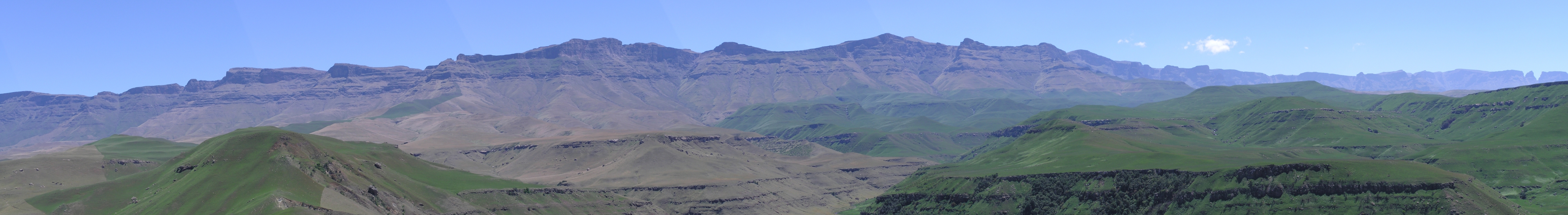
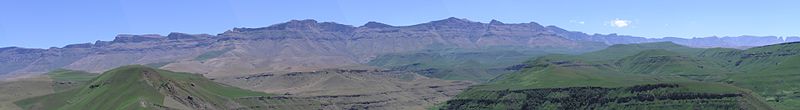
L: 29°20′07″S 29°27′19″E / 29.33528°S 29.45528°E R: 29°04′29″S 29°21′04″E / 29.07472°S 29.35111°E Afrikaans: Panorama van die KwaZulu-Natalse Drakensberg, van die nabye van Giant's Castle, heel links en net buite sig, tot by Cathkinpiek heel regs, 'n direkte afstand van 31 km.
English: Panorama of the KwaZulu-Natal Drakensberg, from the vicinity of Giant's Castle, on left and just out of sight, through to Cathkin Peak at far right, a direct distance of 31 kilometres (19 mi).
Deutsch: Panorama am Giant's Castle, Drakensberge, Südafrika. |
| Usuku | circa 2005 |
| Umthombo | Own work |
| Umlobi | KlausF |
Licensing

|
Permission is granted to copy, distribute and/or modify this document under the terms of the GNU Free Documentation License, Version 1.2 or any later version published by the Free Software Foundation; with no Invariant Sections, no Front-Cover Texts, and no Back-Cover Texts. A copy of the license is included in the section entitled GNU Free Documentation License. |
| This file is licensed under the Creative Commons Attribution-Share Alike 3.0 Unported license. | ||
| ||
| This licensing tag was added to this file as part of the GFDL licensing update. |
Umlando womqulu
Click on a date/time to view the file as it appeared at that time.
| Usuku/Isikhathi | Isithonjana | Dimensions | Umsebenzisi | Amazwana | |
|---|---|---|---|---|---|
| Njengamanje | 08:17, 13 uNhlaba 2005 | 4,000 × 548 (1.4 MB) | KlausF | Panorama am Giant's Castle, Drakensberge, Südafrika {{GFDL}} |
Ukusetshenziswa komqulu
The following page uses this file:
Ukusetshenziswa komqulu jikelele
Amanye ama-wiki asebenzisa lefayela
- Ukusetshenziswa ku-af.wikipedia.org
- Ukusetshenziswa ku-ast.wikipedia.org
- Ukusetshenziswa ku-bg.wikipedia.org
- Ukusetshenziswa ku-bn.wikipedia.org
- Ukusetshenziswa ku-ca.wikipedia.org
- Ukusetshenziswa ku-da.wikipedia.org
- Ukusetshenziswa ku-de.wikipedia.org
- Ukusetshenziswa ku-el.wikipedia.org
- Ukusetshenziswa ku-en.wikipedia.org
- Ukusetshenziswa ku-en.wikivoyage.org
- Ukusetshenziswa ku-eo.wikipedia.org
- Ukusetshenziswa ku-es.wikipedia.org
- Ukusetshenziswa ku-fr.wikipedia.org
- Ukusetshenziswa ku-he.wikipedia.org
- Ukusetshenziswa ku-hr.wikipedia.org
- Ukusetshenziswa ku-hy.wikipedia.org
- Ukusetshenziswa ku-id.wikipedia.org
- Ukusetshenziswa ku-it.wikipedia.org
- Ukusetshenziswa ku-it.wikivoyage.org
- Ukusetshenziswa ku-ja.wikipedia.org
- Ukusetshenziswa ku-ka.wikipedia.org
- Ukusetshenziswa ku-ko.wikipedia.org
- Ukusetshenziswa ku-ky.wikipedia.org
- Ukusetshenziswa ku-nn.wikipedia.org
- Ukusetshenziswa ku-no.wikipedia.org
- Ukusetshenziswa ku-pl.wikipedia.org
- Ukusetshenziswa ku-pt.wikipedia.org
- Ukusetshenziswa ku-sh.wikipedia.org
- Ukusetshenziswa ku-sk.wikipedia.org
- Ukusetshenziswa ku-sr.wikipedia.org
- Ukusetshenziswa ku-sv.wikipedia.org
- Ukusetshenziswa ku-uk.wikipedia.org
- Ukusetshenziswa ku-vi.wikipedia.org
- Ukusetshenziswa ku-www.wikidata.org