
File:Manicaland in Zimbabwe (adm).svg

Size of this PNG preview of this SVG file: Amachashazikazi ama-662 adlulayo nama-600 amile. Other resolutions: Amachashazikazi ama-265 adlulayo nama-240 amile | Amachashazikazi ama-530 adlulayo nama-480 amile | Amachashazikazi ama-847 adlulayo nama-768 amile | Amachashazikazi ama-1,130 adlulayo nama-1,024 amile | Amachashazikazi ama-2,260 adlulayo nama-2,048 amile | Amachashazikazi ama-832 adlulayo nama-754 amile.
Ifayela ewu ngqo (SVG file, nominally 832 × 754 pixels, file size: 269 KB)
Isifinyezo
| Incazelo |
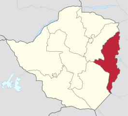
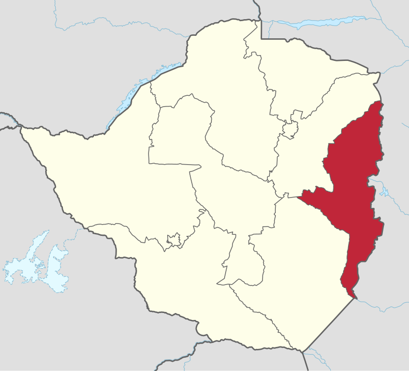
Deutsch: Verwaltungsgliederung von Simbabwe: Lage von Manicaland South.
English: Administrative divisions of Zimbabwe: location of Manicaland South. |
||
| Usuku | |||
| Umthombo |
This file was derived from: Zimbabwe adm location map.svg |
||
| Umlobi |
|
||
| Permission (Reusing this file) |
I, the copyright holder of this work, hereby publish it under the following licenses:
This file is licensed under the Creative Commons Attribution-Share Alike 4.0 International license.
You may select the license of your choice. |
||
| SVG genesis | This locator map was created with Adobe Illustrator. |

.svg)
Umlando womqulu
Click on a date/time to view the file as it appeared at that time.
| Usuku/Isikhathi | Isithonjana | Dimensions | Umsebenzisi | Amazwana | |
|---|---|---|---|---|---|
| Njengamanje | 23:11, 3 uNcwaba 2018 | | 832 × 754 (269 KB) | Furfur | == {{int:filedesc}} == {{Information |Description={{User:Medium69/Traduction}} {{de|1=Verwaltungsgliederung von Simbabwe: Lage von Manicaland South.}} {{en|1=Administrative divisions of Zimbabwe: location of Manicaland South.}} |Source={{Derived from|Zimbabwe adm location map.svg}} |Date=2018-08-04 |Author=* Zimbabwe adm location map.svg: {{U|NNW}} * this file: {{U|Furfur}} |Permission={{self|GFDL|cc-by-sa-4.0}} |Other fields={{Igen|A|+|%|s=m}} }} [[Cat... |
Ukusetshenziswa komqulu
The following page uses this file:
Ukusetshenziswa komqulu jikelele
Amanye ama-wiki asebenzisa lefayela
- Ukusetshenziswa ku-ar.wikipedia.org
- Ukusetshenziswa ku-be-tarask.wikipedia.org
- Ukusetshenziswa ku-be.wikipedia.org
- Ukusetshenziswa ku-ca.wikipedia.org
- Ukusetshenziswa ku-de.wikipedia.org
- Ukusetshenziswa ku-en.wikipedia.org
- Ukusetshenziswa ku-es.wikipedia.org
- Ukusetshenziswa ku-eu.wikipedia.org
- Ukusetshenziswa ku-pt.wikipedia.org
- Ukusetshenziswa ku-sr.wikipedia.org
- Ukusetshenziswa ku-www.wikidata.org
- Ukusetshenziswa ku-yo.wikipedia.org
.svg)