
File:VueAerienneCapFarinaTunisia.JPG
Size of this preview: Amachashazikazi ama-800 adlulayo nama-538 amile. Other resolutions: Amachashazikazi ama-320 adlulayo nama-215 amile | Amachashazikazi ama-640 adlulayo nama-430 amile | Amachashazikazi ama-1,024 adlulayo nama-689 amile | Amachashazikazi ama-1,280 adlulayo nama-861 amile | Amachashazikazi ama-2,048 adlulayo nama-1,377 amile.
Ifayela ewu ngqo (2,048 × 1,377 pixels, file size: 351 KB, MIME type: image/jpeg)
Isifinyezo
| Incazelo |
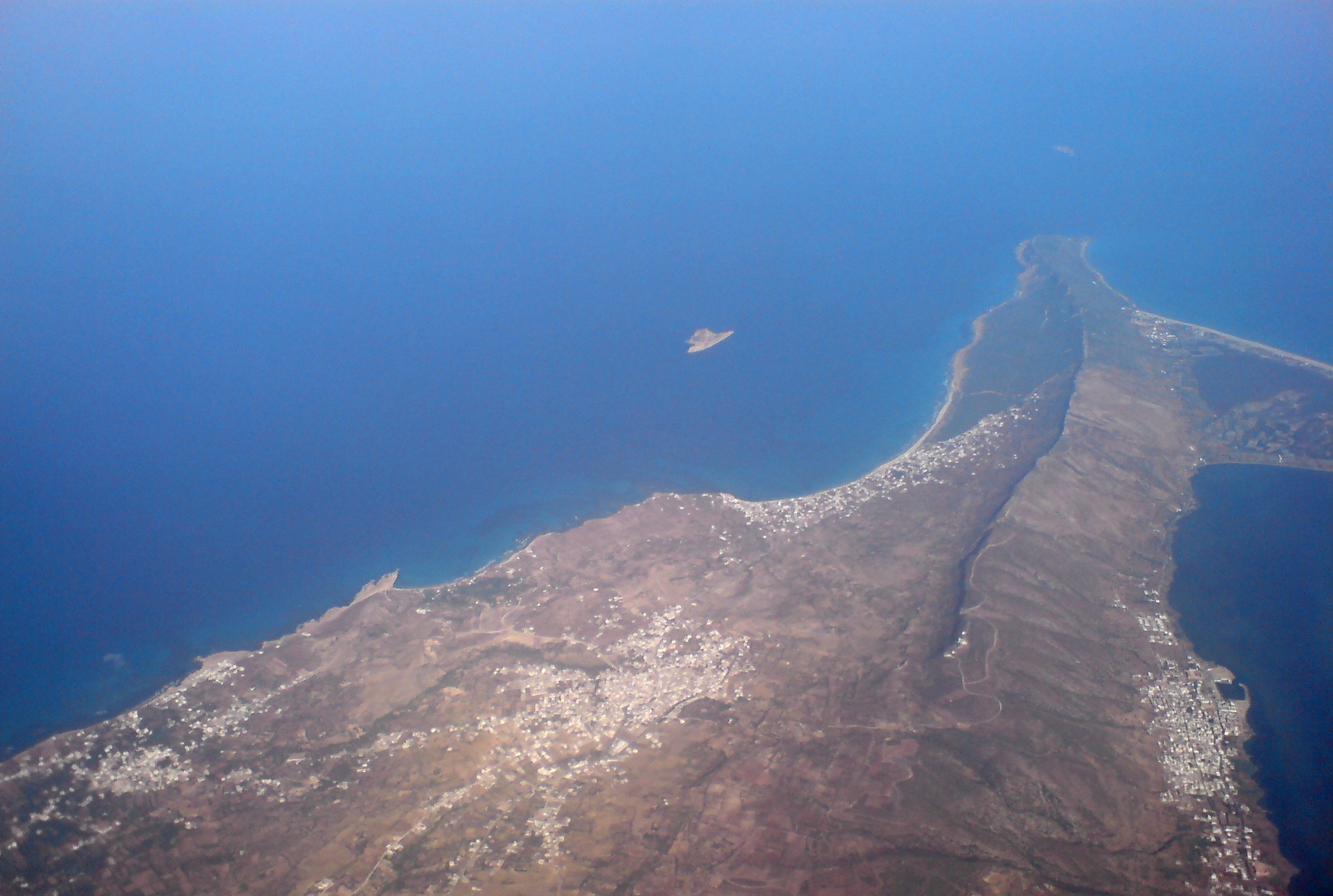
Français : Photo aérienne du Cap Farina en Tunisie, de gauche à droite: Sounine, RafRaf village, RafRaf plage, Ghar El Melh. On voit aussi l'île pilau à gauche et la petite île plane en haut.
English: Aerial photo of Cap Farina, Tunisia |
| Usuku | |
| Umthombo | Own work |
| Umlobi | Citizen59 / Retouche --Pinpin 06:25, 25 September 2007 (UTC) |
| Other versions |
 |
Licensing
I, the copyright holder of this work, hereby publish it under the following licenses:

|
Permission is granted to copy, distribute and/or modify this document under the terms of the GNU Free Documentation License, Version 1.2 or any later version published by the Free Software Foundation; with no Invariant Sections, no Front-Cover Texts, and no Back-Cover Texts. A copy of the license is included in the section entitled GNU Free Documentation License. |
| This file is licensed under the Creative Commons Attribution-Share Alike 3.0 Unported license. | ||
| ||
| This licensing tag was added to this file as part of the GFDL licensing update. |
You may select the license of your choice.
Umlando womqulu
Click on a date/time to view the file as it appeared at that time.
| Usuku/Isikhathi | Isithonjana | Dimensions | Umsebenzisi | Amazwana | |
|---|---|---|---|---|---|
| Njengamanje | 21:01, 28 uMandulo 2007 | | 2,048 × 1,377 (351 KB) | Pinpin | retouche |
| 13:03, 24 uMandulo 2007 |  | 2,048 × 1,536 (797 KB) | Citizen59 | {{Information |Description=Aerial photo of Cap Farina, Tunisia |Source=travail personnel |Date=19 September, 2007 |Author= Citizen59 }} |
Ukusetshenziswa komqulu
Awekho amakhasi asebenzisa lolu hlobo lomqulu.
Ukusetshenziswa komqulu jikelele
Amanye ama-wiki asebenzisa lefayela
- Ukusetshenziswa ku-de.wikipedia.org
- Ukusetshenziswa ku-fr.wikipedia.org
- Ukusetshenziswa ku-ha.wikipedia.org
- Ukusetshenziswa ku-ig.wikipedia.org
- Ukusetshenziswa ku-uk.wikipedia.org